

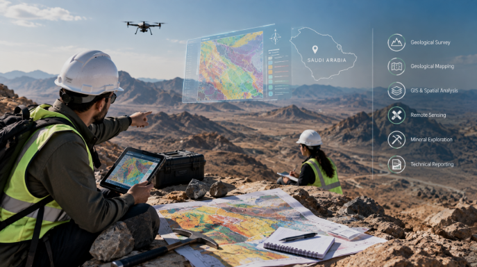
The truth is that the decision-makers need to understand the ground conditions in which they are working, even before the mining exploration, natural-resource project or the infrastructure moves into a major investment phase. Rock types, geological structures, terrain, and spatial relationships can influence where exploration should continue, where drilling may be justified, and how project activities should be planned.
Geological Survey and Mapping Services provide that foundation. By combining field observations with mapped geological information, these services help project teams build a clearer picture of site conditions and make technical decisions using evidence rather than assumptions.
What Are Geological Survey and Mapping Services?
Collecting and evaluating information directly from a project area is called geological surveying. In this, geological surveying focuses on collecting and assessing information directly from a project area. Geologists examine exposed rocks, geological contacts, structures, terrain, mineralization indicators, and other relevant site characteristics. Geological mapping takes those observations and represents them spatially. The resulting maps may show rock units, faults, folds, structural trends, alteration zones, terrain features, sampling locations, and other geological information. Together, surveying and mapping create an organized geological framework that can support exploration, engineering, site assessment, and project planning.
What Do Geological Survey and Mapping Services Include?
To start with, a geological survey of Saudi Arabia may start with a stage of field reconnaissance. Then, geologists visit the site to have an understanding of rock exposure, accessibility, the general geological setting and the terrain. This happens before comprehensive work. Detailed geological mapping records lithology, geological contacts, alteration, and observable mineralization. Structural mapping focuses on features such as faults, fractures, folds, veins, and orientations because structures can influence geological interpretation and potential mineral controls.
Terrain and topographic assessment add another practical layer. Slope, elevation, drainage, and access conditions can affect fieldwork, drill-site planning, and later infrastructure decisions. Field data collection may include coordinates, photographs, geological descriptions, structural measurements, and sample locations. Good documentation is essential because later geological data analysis depends on knowing where information came from and how it was collected.
Satellite and other spatial data can also support interpretation by providing additional context between field observations. After this, technical reporting helps in bringing the information together. Data like field records, maps, recommendations and interpretations permit technical teams along with decision-makers to understand what was noted and what investigation is further required.
Why Geological Mapping Matters for Mining and Exploration
It is to understand that mineral exploration rarely progresses efficiently without a geological framework. Mineral exploration mapping helps teams understand where favorable rock units, structural features, alteration, or other geological indicators occur. This can support geological assessment, target identification, exploration planning, and later drill planning. For example, field mapping may show that a structural zone continues beyond an initially recognized outcrop. Sampling and other exploration methods can then test whether that feature warrants additional investigation.
As exploration progresses, improved geological interpretation can also contribute to resource evaluation and mine-development decisions. The purpose of mapping is not to guarantee mineral discovery. It is to reduce geological uncertainty and help teams decide where further technical work is most justified.
Geological Survey vs Geological Mapping: What Is the Difference?
A geological survey is primarily about collecting and evaluating information about geological conditions. Geological mapping is about organizing and representing that information spatially. The two activities work together. A map without reliable field observations may oversimplify site conditions, while field notes without spatial organization can be difficult to interpret across a larger project area. Effective Geological Survey and Mapping Services combine both processes so geological observations can be understood in their correct location and regional context.
How GIS Supports Geological Mapping
GIS is a supporting technology that helps geologists organize, visualize, and analyze spatial information. Different geological layers can be brought together within a GIS environment, including mapped rock units, structures, sample locations, terrain information, access routes, and other project data. This allows GIS geological mapping to show relationships that may be difficult to recognize in separate spreadsheets or field records. For example, teams can compare sample locations with structural trends or examine how geological features relate to terrain. GIS does not replace geological interpretation. Its value is in helping geological consultants manage and visualize information more effectively.
When Do Businesses Need Geological Survey and Mapping Services?
These services can be useful at several project stages.
- Early-stage exploration companies may require them to understand a prospective area before detailed sampling or drilling. A project undertaking geological assessment may need new field information to validate existing maps or historical datasets.
- Mapping can also support mineral target development, exploration planning, and drill-site selection. During resource evaluation or mine development, more detailed geological information may help refine technical understanding of the project area.
- Outside mining, engineering, and infrastructure developers may require geological assessments where ground conditions could influence site planning or development decisions.
How to Choose a Geological Survey Company
Start with geological expertise and relevant field experience. The provider should understand both data collection and geological interpretation. Review its mapping capabilities, field documentation procedures, and approach to data quality. A reliable geological survey company should be able to explain how observations are recorded, checked, mapped, and incorporated into technical reports.
GIS capability is useful, but it should complement rather than replace field geology. The provider should also be able to integrate spatial information with geological observations. Finally, assess whether its geological consulting services match the project’s purpose. Exploration, infrastructure, and resource-assessment projects can require different levels of detail and technical interpretation.
Conclusion
Reliable geological information provides the foundation for better exploration and project decisions. Geological Survey and Mapping Services combine field observations, structural mapping, spatial data, geological interpretation, and technical reporting to create a clearer understanding of site conditions.
For projects in Saudi Arabia, experienced geological consultants can help transform scattered field information into useful maps and technical interpretations. WECO currently provides geological survey, terrain mapping, GIS visualization, and related exploration support for mining, exploration, and infrastructure projects in Saudi Arabia.
FAQs
How do I choose the right geological survey company in Saudi Arabia?
Look for field experience in Arabian Shield terrain, not just mapping software. The provider should explain how observations are recorded, checked, and turned into technical reports. GIS should complement field geology not replace it. Match the consulting services to your project stage: exploration targeting needs different interpretation than infrastructure site assessment.
What is the difference between geological surveying and geological mapping?
A geological survey collects data from the field rock types, structures, alteration, mineralization. Geological mapping organizes that data spatially into a usable framework. One without the other fails. Combined, they reduce geological uncertainty and support exploration planning, drill-site selection, and development decisions.
When should a company invest in geological survey and mapping services?
Before committing capital. Early-stage explorers need it before sampling or drilling. Project teams use it to validate historical data. Resource evaluation and mine development use it to refine technical understanding. Infrastructure developers use it to assess ground conditions. It is always cheaper than correcting wrong assumptions later.
How does GIS support geological mapping?
GIS organizes and visualizes spatial data rock units, structures, sample locations, terrain, access routes so relationships become visible. It strengthens the connection between field observations and technical decisions. But GIS does not replace geological interpretation. It supports it.
Why is geological mapping important for mineral exploration in Saudi Arabia?
Mapping shows where favorable rock units, structures, and alteration occur. It may reveal a structural zone extending beyond known outcrops, giving sampling programs clear direction. The purpose is not to guarantee discovery it is to reduce uncertainty and decide where further work is justified. In the Arabian Shield, where ground remains underexplored, that framework is the foundation for every exploration decision.