

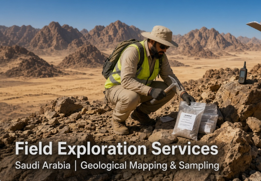
It takes more than a map and a history reference for it to be a mining company. Reliable information from the ground is key to making decisions for early exploration. Field exploration services link desk studies with higher-cost exploration. Geologists use mapping, sampling, and observation and site assessment to determine if an area is worthy of continued investigation and where to focus future efforts.
At WECO, field exploration is an integral part of the geological support that is given to mining and exploration projects in Saudi Arabia.
What Are Field Exploration Services?
On-site activities that are performed to learn about the rocks, structures, alteration, mineralization, and physical conditions of a prospective area are referred to as field exploration services. These are usually carried out in conjunction with geological reconnaissance, geological mapping, rock and soil sampling, structural observations, field measurements, geological site assessment, and target identification. The intent is to gather reliable geological information to evaluate assumptions and determine possible exploration opportunities, rather than to make a discovery. In Saudi Arabia, fieldwork may also be used to verify the information obtained from maps, remote sensing data and historical studies, or geological databases.
Key Activities Involved in Field Exploration
1. Geological Reconnaissance and Site Assessment
Reconnaissance provides geologists with an up-to-the-minute knowledge of an exploration area. They discuss rock exposure, terrain, access, alteration, mineralization, and/or other features that would affect exploration planning.
2. Geological and Structural Mapping
Records rock types, contacts, faults, folds, veins, alteration zones and other features of interest. Structural observations can aid in understanding the controls of mineralization.
3. Rock and Soil Sampling
The sampling method is used to test the observations made in the field in the lab. Samples of rock can be collected from alteration zones, veins or outcrops, or soil can be sampled to detect geochemical changes under favorable surface conditions.
4. Field Data Validation and Target Identification
The exploration record consists of coordinates, photographs, sample numbers, lithological descriptions, and structural measurements. Data validation is important, as a lack of data or poor documentation in locations can diminish later interpretation. Combined with field observations and analytical results, geologists can identify and prioritize the targets for follow-up. Geological evidence, geochemical response, structural setting, accessibility, and project objectives can be all considered for exploration target generation.
5. Technical Documentation and Reporting
The results of the fields need to be translated into useful technical information. Maps, sample registers, photos, interpretations, and recommendations enable exploration managers to know what was done and what action they should take next.
Why Field Exploration Matters Before Drilling
Drilling is a significant leap in exploration cost and commitment prior to significant investments in drilling programs. The process of field exploration helps to reduce the number of prospective areas from broad to specific areas before selecting the drill targets. The process of interpretation using geology can be reinforced or refuted by remote sensing observations or by existing data sets. Sampling can help determine where follow-up is needed, and structural mapping can help to better understand possible mineralization controls. Other methods cannot be replaced by fieldwork. It is used in conjunction with geochemical analysis, GIS, remote sensing, geophysics, and exploration drilling. The methods convey varying types of evidence.
How Field Exploration Supports Mineral Exploration in Saudi Arabia
Field Exploration as a tool for mineral exploration in Saudi Arabia. The contribution of field exploration in mineral exploration in Saudi Arabia. National geoscience data and geological mapping is extensive in Saudi Arabia, however there is still a need for site-specific validation for project-level decisions. Regional information does not always apply to the site of any particular exploration area due to terrain, outcrop quality, access and local geological complexity. Combining existing geological information with on-site surveys, mapping, sampling, and target assessment is all within the reach of professional mining exploration services KSA.
There is also the option of experienced exploration consultants, geological consultants, and an exploration geology consultancy to add to field observations, GIS, remote sensing, geochemistry, and previous exploration histories. This helps to ensure a more professional approach to the exploration and assessment of Saudi resources, while not taking the stance that all prospective areas should be advanced to drilling. WECO plays a vital role in this process by providing field exploration, geological assessments, mapping, sampling and other technical services specifically geared towards the needs of mining projects in Saudi Arabia.
When Should a Company Use Field Exploration Services?
They are useful in early-stage mineral exploration, geological assessment of a prospective area, validating existing information, generation of exploration targets and preparation for detailed drilling.
How to Evaluate an Exploration Services Provider
Consider more than just the number of people on the team. A competent provider should have some geological knowledge, experience in the field, defined data-management protocols and an understanding of the broader exploration process. Inquire about documentation of samples and observations, verification of field data, coordination of activities, and technical reporting will be provided. Safety procedures, field logistics, communication, and knowledge about the conditions in Saudi projects is also a factor.
Conclusion
Reliable exploration decisions start with reliable field information. Field exploration services enable companies to transition from a general view of geological potential to more refined exploration targets, by providing reconnaissance, mapping, sampling, validation, and interpretation. Mineral exploration companies can make use of geologists to transform the available information into a well-defined field program and to give a more solid technical foundation for determining the next steps in the exploration process, such as the decision on where and whether to continue exploration in Saudi Arabia. WECO’s exploration and geological services contribute to this process of investigation to informed decisions on exploration.
FAQs
What are field exploration services?
Field exploration services involve on-site geological work such as reconnaissance, mapping, sampling, site assessment, and target identification to support mineral exploration decisions.
What is included in field exploration services in Saudi Arabia?
They may include geological mapping, rock and soil sampling, structural observations, field-data validation, target generation, and technical reporting based on the project requirements.
Why is field exploration important before drilling?
Field exploration helps identify and prioritize more suitable targets before drilling, using geological observations, sampling, and existing exploration data to support better decisions.
How does field exploration support mineral exploration in Saudi Arabia?
It provides site-specific geological information that can be combined with regional data, GIS, remote sensing, and previous studies to improve exploration target assessment.
How do I choose a field exploration services provider in Saudi Arabia?
Look for geological experience, reliable field data and sampling practices, clear technical reporting, strong HSE procedures, and experience with exploration projects in Saudi Arabia.